Community engagement software
The conversation
has changed.
We help you build trust
and earn support.

600+ real estate, municipal and planning teams in North America trust coUrbanize for meaningful and equitable engagement.


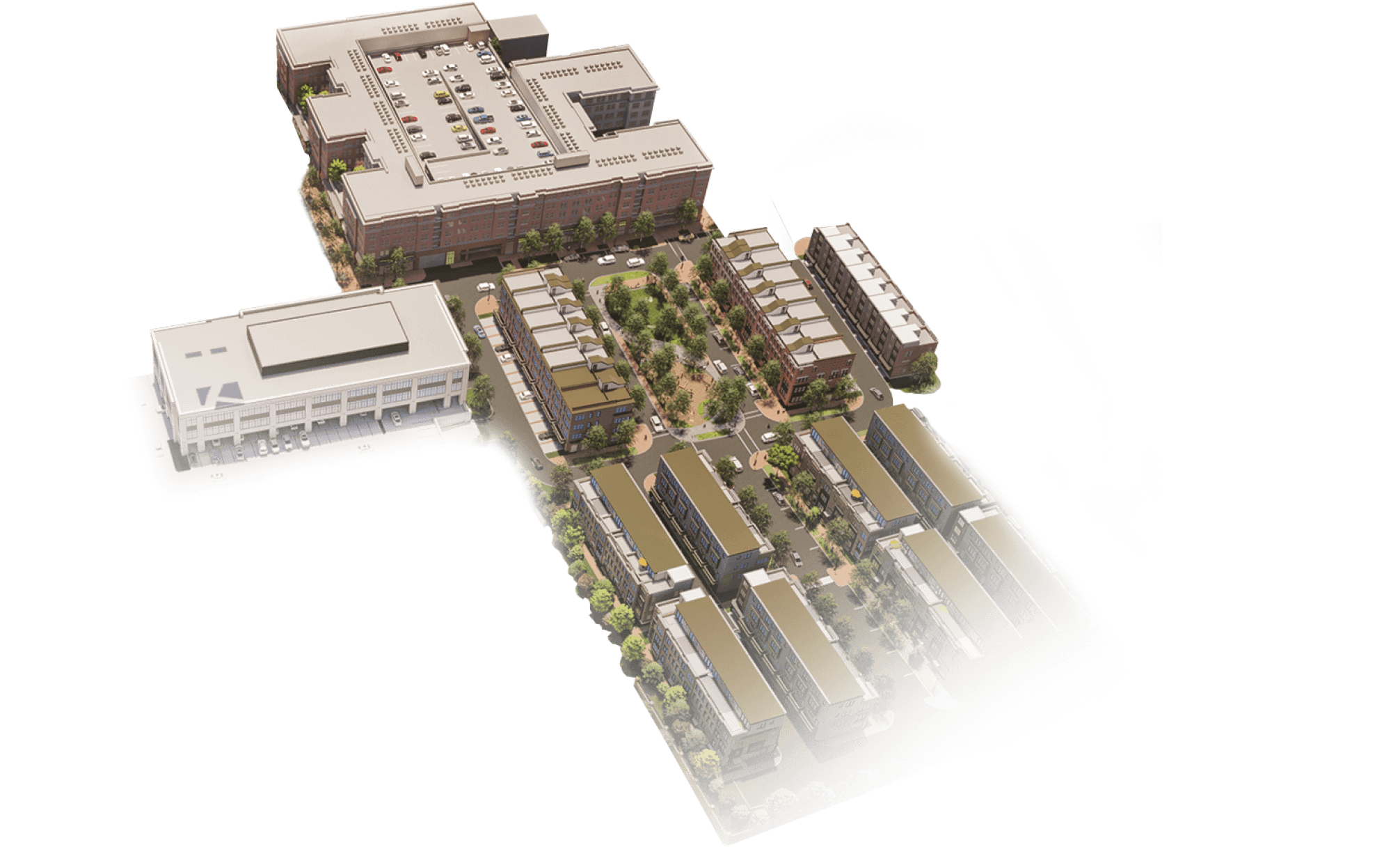
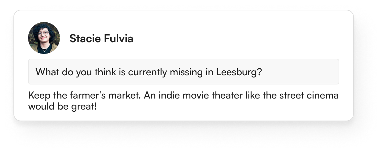

Client Success Story - Suburban Redevelopment
Leveraging community feedback to shape a suburban strip mall’s future
Keane Enterprises tapped into the 35 and under demographic using coUrbanize’s best practices for outreach, and incorporated meaningful feedback into project plans
Virginia Village case study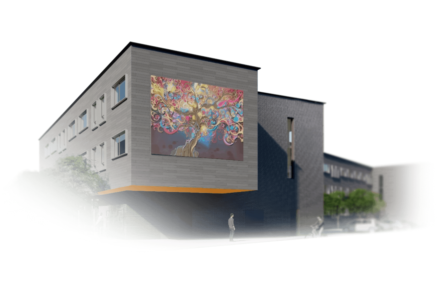
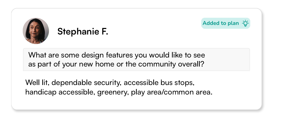
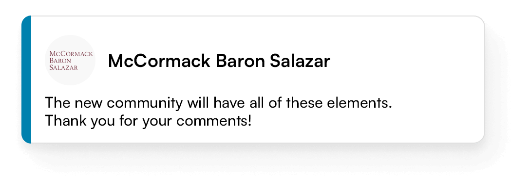
Client Success Story: Affordable Housing Development
Ensuring community buy-in for a Chicago affordable housing project
Preservation of Affordable Housing utilized unexpected community feedback to establish a sense of ownership and earn trust for their eco-friendly Garfield Park development
POAH case study
Client Success Story: Urban mixed-use development
Gathering hard data to share with local politicians
Silverstein Properties shared more than 1,600 comments with New York City Councilmembers, gaining approval for a $2 billion mixed-use development
Innovation QNS case study600+
Projects
31
States +Canada
27
Languages Translated
92%
Positive Comment Sentiment

The beauty of coUrbanize is that it gives voice to those who feel like they’re voiceless.

In communities where we haven’t used coUrbanize and faced opposition, we’ve seen entitlements drag on for an additional 12 to 18 months. The total added cost is in the tens to hundreds of thousands of dollars with additional permitting, legal, and overhead expenses plus costs associated with design changes.

coUrbanize helped us engage with more people in the community, which was ultimately one of the most important critical success factors for this project. Our partnership with coUrbanize helps us unlock more value for our clients, like the City of Detroit, while also creating a more inclusive partnership process.

The fact that coUrbanize is plug-and-play provides big cost savings. We didn’t have to hire a web developer and design a website. Compared to setting something up from scratch there is a cost savings in dollars as well as time. We set up coUrbanize in a matter of weeks – it was extremely fast and very reactive.

Without coUrbanize it would have been much more difficult for us to state our case to City Councilmembers. We were able to produce hard evidence and analytics showing that 80% of project comments were positive…Those kinds of analytics are difficult to get with only in-person outreach.

Residents have expressed that they have been so grateful to have new and accessible tools to communicate their thoughts and participate in this process. Participation has long been a function of privilege, and the way we were doing engagement before doesn’t feel right anymore…This was such a unique opportunity to make the process more honest, open, and transparent.
Our Impact
Community users make their voices heard
A local musician’s suggestion for developers on coUrbanize resulted in the addition of artist housing to a new development in her neighborhood.